AMARAVATI COSMOSA CITY OF POSSIBILITIES
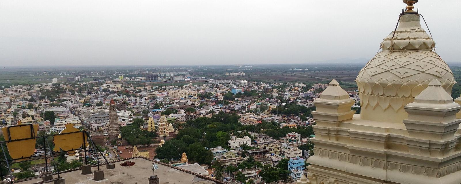
A wide view over the rooftops and temple towers of Mangalagiri town, with fields beyond

LIVING

Life in and around the capital.

Location, healthcare and connections, for anyone thinking about living in or near Amaravati. A starting point for your own checks, not a recommendation.

Mangalagiri town, next to the capital area, seen from Mangaladri hill, June 2017. Photo: Aniltech2017, CC0 (public domain), via Wikimedia Commons.

Schematic map of the Amaravati capital region Not to scale. The Krishna river runs west to east. Amaravati capital city lies on its south bank, west of Tadepalli. Vijayawada is on the north bank opposite Tadepalli, at Prakasam Barrage. Mangalagiri, with AIIMS, is south of Tadepalli, and Guntur further south. Vijayawada Airport is north-east of Vijayawada. The approved railway line runs from Errupalem in the north through Amaravati to Namburu near Mangalagiri. A proposed Outer Ring Road circles the region. Amaravati Tadepalli Vijayawada Prakasam Barrage MangalagiriAIIMS Guntur Errupalem Namburu Vijayawada Airport Krishna river
  • Capital city (approximate area)
  • Krishna river
  • New railway line (approved)
  • Outer Ring Road (proposed)
Schematic, not to scale; positions are approximate. See the sources for each project below.

Latest official updates

All updates →

Checking official sources…

Loading official updates…

Cosmos summarises public sources. Always check the original source before making a decision, and read dates as the date of the evidence, not of today.

Tendering; approval pending

Outer Ring Road

NHAI has invited bids for a 195 km, six-lane, access-controlled Outer Ring Road around Amaravati in four packages worth about ₹11,538 crore, with bids due on 18 November. Reports say formal Union Cabinet approval was still pending. Estimates of the total project cost vary widely between sources.

Sources: The News Minute (October 2026)

Under construction

Vijayawada Airport's new terminal

A new terminal building at Vijayawada Airport (Gannavaram), the nearest airport to the capital, was reported in September 2026 to be expected by October after a new contractor took over. Earlier deadlines in 2025 and 2026 were missed. Cosmos has not confirmed whether it has opened.

Sources: ThePrint (PTI) (September 2026) · Deccan Chronicle (July 2026)

Operational

AIIMS Mangalagiri

AIIMS Mangalagiri, next to the capital area, states that 500 hospital beds are currently functional. Its listed services include X-ray, ultrasound, CT and MRI, PET scan, dialysis, a 60-bed trauma and emergency department, and radiation oncology equipment.

Sources: AIIMS Mangalagiri (undated (checked 2026-11-13))

Approved

New railway line through Amaravati

The Union Cabinet approved a new 57 km railway line from Errupalem to Namburu via Amaravati on 24 October 2024, at a reported cost of about ₹2,245 crore, with nine new stations and a completion period of five years. The state later approved pooling about 6,212 acres of land for the line. Cosmos has not found a construction progress update.

Sources: Press Information Bureau (24 October 2024) · ThePrint (PTI) (24 October 2024) · The South First (2025)

Where the capital city is

The capital city covers roughly 217 square kilometres on the south bank of the Krishna river in Guntur district, drawing villages from Thullur, Mangalagiri and Tadepalli mandals. Sources count the villages differently (from 24 to 29), depending on date and on how hamlets and municipal areas are counted.

Sources: APCRDA (draft gazette) (undated) · Wikipedia (continuously updated)

Sources last checked 13 November 2026. Spotted something out of date? Tell us.